Icelandic River Guides

Kayaking on Icelandic Rivers

Browsing Posts in River Guide

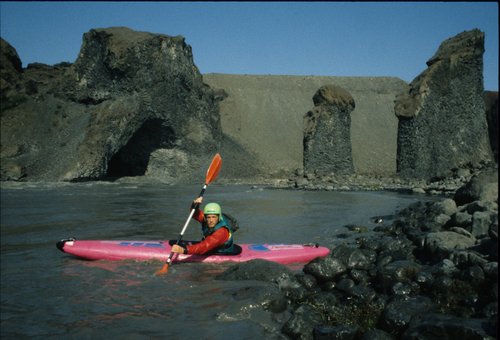
Kayaking on the Jökulsá á Fjöllum in the Jökulsárgljúfur National Park.

River:  Jökulsá á Fjöllum

Grid Reference: 65deg55′N; 16 deg 28′W

Grade: IV (if you get the line right)

Length: 15Km

Date Run: 07.08.89 & 01.08.91

Weather Conditions: Warm and sunny

River Level: Medium

Significant portages: None

continue reading…

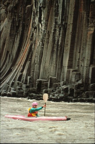
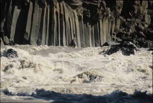
Ian, on the Bru, and Basalt columns

River: Jokulsá á Brü

Grid Reference: 65 deg 15′N; 15 deg 20′ W

Grade: V

Length: 70km

Date run: 01.08.89 + 02.08.89

Weather conditions: Grey.

River level: 450 cumecs / Medium

Significant portages: 3

continue reading…

Hamarsá

No comments

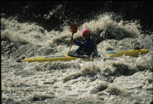
Rob on the top fall of the Hamarsa

River: Hamarsá

Grid Reference: 64deg6″N; 14deg53″W

Grade:  III

Length:  3.5km

Date run:

Weather conditions:  Gray

River level:  Medium

Significant portages: None.

continue reading…

Tom on the Bru

River: Jokulsá á Brü

Grid Reference: 65 deg 15′N; 15 deg 20′ W

Grade: V

Length: 18km

Date run: 31.07.91.

Weather conditions: Hot and sunny.

River level: 450 cumecs / Medium

Significant portages:  None

continue reading…

River: Hverfisfljot (lower section)

Grid Reference: 63deg52′N; 17deg45′W.

Grade: Upper section has lots of V and IV drops. The lower section is III.

Length: 3km (lower section)

Date run:  23.07.91.

Weather conditions:  Light drizzle

River level:  Medium/high.

Significant portages:  None on the lower section.

continue reading…

Markarfljot Canyon

River: Markarfljot (Canyon section)

Grid Reference: 63 deg 45* N; 19 deg 22′ W.

Grade: V/VI.

Length: 10 km.

Date run: Inspected 15.07.91.

Weather conditions: Hot and sunny.

River level:

Significant portages: Ideally one, but very difficult to do.

continue reading…

Hvitarvatn

No comments

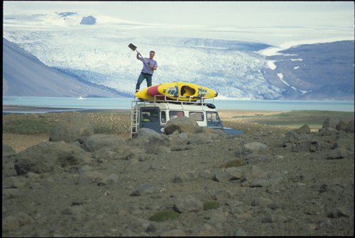
Happy man with shovel, Hvitarvatn

River: Hvitarvatn

Grid Reference: 64deg32′N: 20degl3′W

Grade: Flat Water Lake in Spectacular Scenery

Length: 10 km

continue reading…

Tom on Dangleberry Drop

River: Hvita i Arnessyslu (upper section)

Grid Reference: 64 deg 32′ N; 20 deg 13′W.

Grade: IV with one V

Length: 13 km

Date run: 11.07.91

Weather conditions: Fine

River level: Medium

Significant portages: None

continue reading…

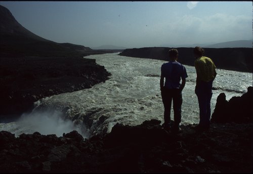
Viewing a HFD on the Pjorsa

River: Pjorsa (canyon to the south of Burfell)

Grid Reference: 64 deg 5′ N; 19deg50′ W.

Grade: V and VI

Length: ???

Date run: Inspected 09.7.91.

Weather conditions: Hot and sunny.

River level: Huge and foamy.

Significant portages: Numerous.

continue reading…

Tom on the rapid above Aldeyjarfoss

River: Skjalfandafljot

Grid Reference: 65 deg 19′ N;   17 deg 20′ W.

Grade: IV

Length: 10 km

Date run: 04.08.91

Weather conditions: Hot and sunny

River level: Medium??.

Significant portages: One

continue reading…