
Tom on the Bru
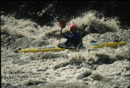
Tom on the Bru
River: Jokulsá á Brü
Grid Reference: 65 deg 15′N; 15 deg 20′ W
Grade: V
Length: 18km
Date run: 31.07.91.
Weather conditions: Hot and sunny.
River level: 450 cumecs / Medium
Significant portages: None
Access arrangements
Put in at Merki where the bridge goes over the river.
Egress
Take out on the North bank 18km downstream by the flow measuring hut 1.5 kms below the next bridge over the Bru.
Description
This section is 18 kms of big volume grade V with some easy flat bits between the rough sections. The first major obstacle is a scaled up version of the serpents tail on the Dee. The river is very boily and the waves are huge. This is followed by a large rapid on a left hand bend adjacent to the route 1 junction. Inspect before rarining. The river continues with some huge waves before p-asing of for a few kms. Another left hand bend and the action starts again. Go left of the island andAvoid the huge hole in the main channel, more big waves and scary boils. More big rapids and then the river hits “Boil city”, a small trench that’s far to small for the volume of the river. There are no particular hazards except numerous richochetting boils. Egress after another section of big waves.